WHY THIS STRIP?
This strip, about 3 kilometers long and two building blocks wide, is located right in between two major axes, axes of great importance for Brooklyn. They were important in the development of Brooklyn, being already one of the main roads for the Indian tribes, and later on with the arise of the Atlantic Branch of the LIRR.
But it is their present function that makes them so important. One is a big commercial artery, Fulton Street, and the other one, the Atlantic Avenue, starts with a predominant commercial character but is mostly important in Brooklyn for its industrial and manufacturing function.They both go from the west of Brooklyn to the east, with the Atlantic Avenue being the longest, starting in the Brooklyn Bridge Park. And by doing so, they provide a connection to Manhattan.
They do not only form a strong longitudinal connection, but because of that strong direction, they create a border in between neighborhoods. This border is highly visible when we look at the boundaries of the existing neighborhoods. The precise borders of the different neighborhood can differ, it depends on the source. But the strip will always form that distinct line.
This part of the strip is different from the rest because of the fact that the tension between those two axes is very tangible here. And it is this tension that is interesting to play with, and by doing so making this strip a much more efficient piece of the city.
These adjustments wouldn’t only be directed in the longitudinal way, but also in the transverse direction, implementing a connection between the different neighborhoods. By setting these conditions it will be possible to create a toolbox of potential interventions, ranging from strengthening the two dominant functions along the two streets, and simultaneously connect the two axes through this zone.
For analyzing the zone, it is possible to distinguish two strong entities, the two streets and the strip of building blocks. Each entity has there variations.
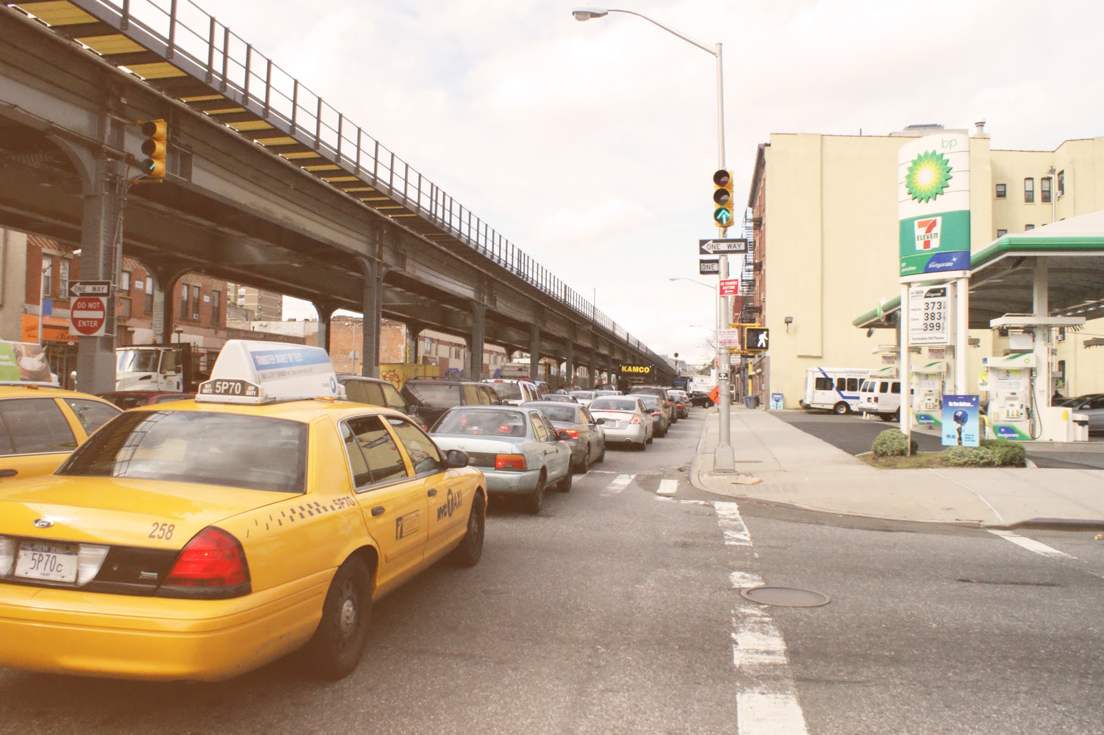
The Atlantic Avenue and Fulton Street are very different, not only because of their different land use, but also through their infrastructure and their users. As previously mentioned, the Atlantic Avenue is prominently manufacturing and industrial but with a lot of other functions mixed in with it. And the Fulton Street is clearly a commercial street.The main difference in infrastructure between these two routes is the elevated LIRR train on the Atlantic Avenue. The elevated train causes a reinforcement of the longitudinal direction and hides the connections that are there on a transverse direction. The elevation of the train creates, through height, different experiences of the AA and the adjacent buildings. It also creates a distinct atmosphere right beneath the construction.
The numbers of lanes of the two streets also varies, from two on one side and three on the other, with one parking lane, for the Atlantic Avenue and only two on Fulton Street, with two parking lanes.
And important for its commercial function, underneath the Fulton Street is an important subway line, the A&C-line.
There is also a big difference in users in between the two streets. You can see that there is always one privileged direction with different kind of users. The subway uses the Fulton Street, and linked with this is the large number of pedestrians on Fulton Street and the transverse streets from and to Fulton. The Atlantic Avenue on the other hand, is mainly used by automobiles and the LIRR of course.
Based on these three levels of differences are some adjustments possible.
-The already prominent industrial/manufacturing for the Atlantic Avenue and commercial for Fulton will be increased. This by adding buildings and adding stories, which is possible on Fulton because the street is oriented north.
-To give the place under the LIRR also a function like much needed parking space, alternating with a covered market place. By doing so it will create an interesting tension between the permanent commercial function of Fulton Street and the temporary function of this place.
-Also because of the height of the elevated train, the industrial character of the environment it is possible to build high buildings. Which will also serve as a sound buffer for the LIRR.
-Because of there is a high amount of pedestrians on the FS, cold it be also a good idea to interrupt the strong street wall with a public function.
-The already prominent industrial/manufacturing for the Atlantic Avenue and commercial for Fulton will be increased. This by adding buildings and adding stories, which is possible on Fulton because the street is oriented north.
-To give the place under the LIRR also a function like much needed parking space, alternating with a covered market place. By doing so it will create an interesting tension between the permanent commercial function of Fulton Street and the temporary function of this place.
-Also because of the height of the elevated train, the industrial character of the environment it is possible to build high buildings. Which will also serve as a sound buffer for the LIRR.
-Because of there is a high amount of pedestrians on the FS, cold it be also a good idea to interrupt the strong street wall with a public function.
The zone in between these two axes is above all a residential zone, interspersed with a big public function like a school, sport fields, or a hospital. It has a high percentage of vacant lot, about 6,5%, and a lot of parking lots. Open public space is scarce, because most of it is school property.
Looking at the zoning over the years, it has changed but is more or less the same since 1961.The strip is a combination of different building blocks, which can be divided in more or less three scales.
SMALL: a typical building block with mostly residential buildings, houses of one to three storeys .
MEDIUM: a combination of different building forms, with different functions, randomly arranged.
LARGE: when a complete building block consists of one function, usually a public function.
It is this wide range of building blocks that make the strip interesting. They all should be treated differently. And by doing so a lot of different tools are possible.